
The FiberScript functionality for deploying the aerial network
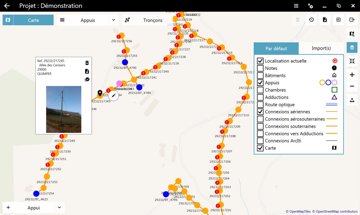
The poles field survey functionality allows the deployment and/or maintenance of the aerial network. Create your sections and poles sheets on a background map with the help of ergonomic software, perfectly adapted for use on a tablet.
Intuitively enter all information relating to field reconnaissance, pole type, etc..
The use of the tablet support allows the automatic generation of a COMAC study or an Excel file that can be interpreted by the CAP-FT software.
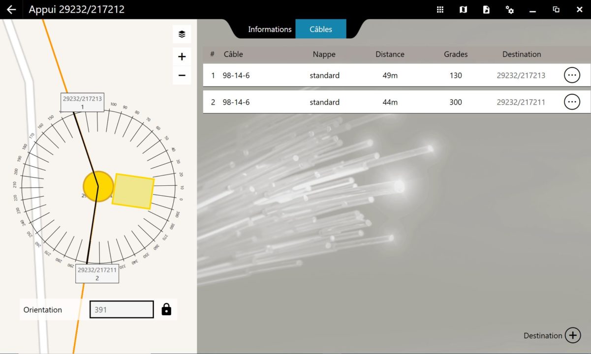
Cable pathways
Make effective note of the cable paths by indicating the type and destination of the cables. The corresponding lengths are calculated automatically.
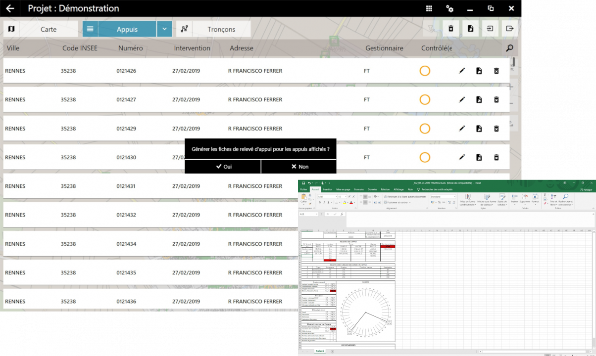
Pole sheet
Fill in all your poles sheets using a form perfectly adapted to the input of technical data and generate your sheets in Excel format.
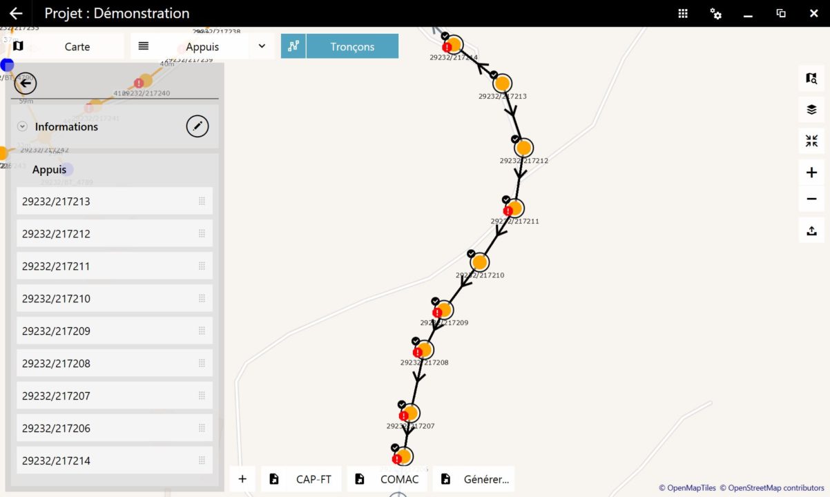
Compatible with CAP-FT and COMAC software
Generate a COMAC study in PCM format or an Excel file that can be interpreted by the CAP-FT software. Perform mass calculations and minimize post-processing of the CAP-FT export.
Mass import of GESPOT and PIT Orange
Import all your poles very easily thanks to the mass import of your GESPOT files in CSV format and PIT Orange in Shapefile format.
GPS coordinates
Locate your poles on the map, the software automatically shows their GPS coordinates as well as the associated addresses.
FiberScript, a flexible and modulable solution!
Your field surveys recorded on the cloud
Benefit from a secure storage of your data on our servers
Exchange your data between FiberScript users
Recover your data in case of loss, theft or renewal of your equipment!